
| Note: This feature is available in SpatialKey Client for Windows applications, i.e., Map Analyst, Hazard Analyst and Accumulations. |
Do you have another dataset that could be used to enhance your existing dataset? Do you want to create thematic maps by a shapefile of your choice? Is your shapefile too complex for simple “filter my data by shape” actions in your dashboard?
… if you answered yes to any of these questions, creating data joins may be right for you!
Joining datasets together is very easy with SpatialKey and can be done if you are the Creator/Editor or Contributor of a dataset. This page will walk you through the types of joins that you can create and the various ways in which you can set them up. Once you have joins setup, you can use them in your dashboard to further enhance your analytics. Check out this article for tips on using dataset joins in your dashboard.
Types of joins
Joining two point datasets
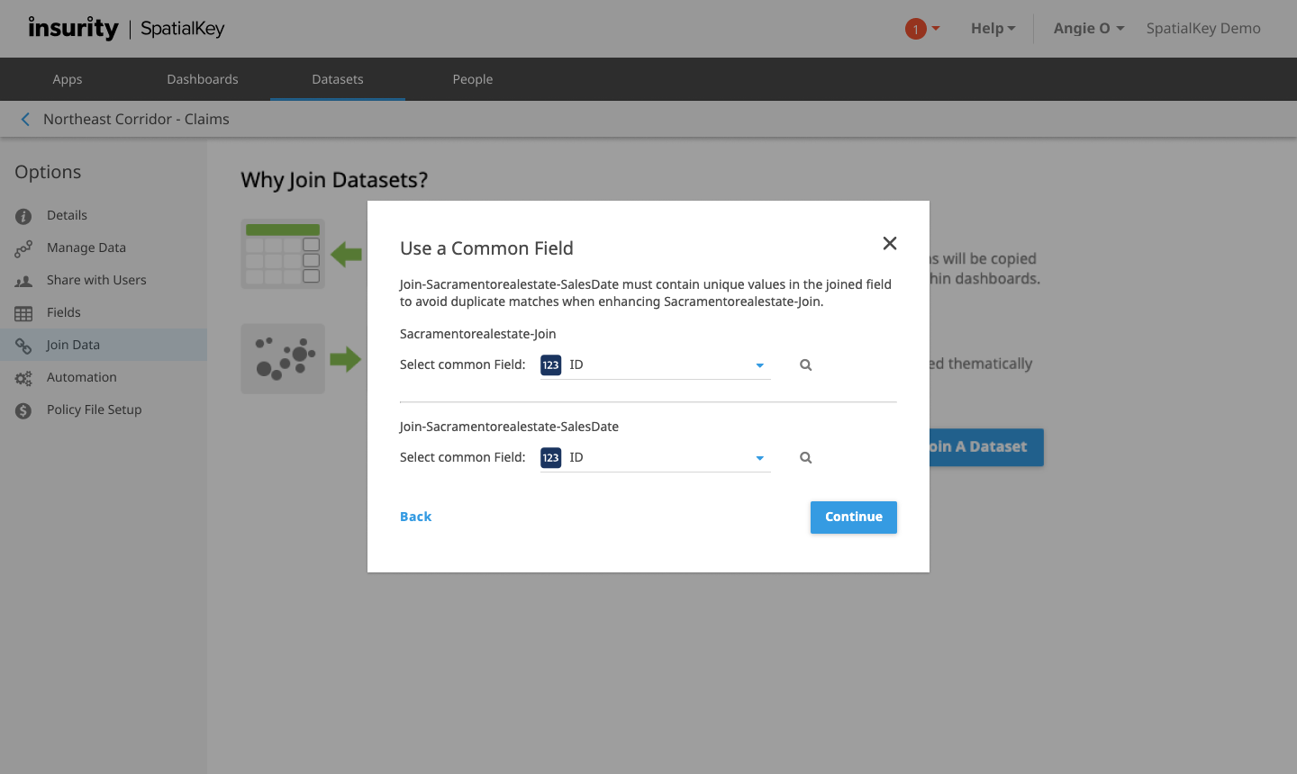
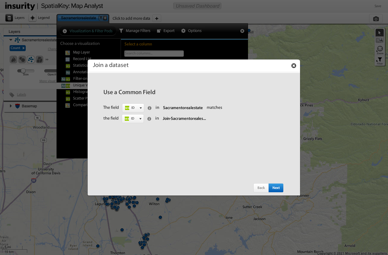
Two datasets can be joined to allow data from a secondary dataset to be displayed along with data from the first as if the secondary data was part of the primary. When joining the datasets you select a field from each dataset to be used to align and merge the datasets – these two fields must be the same data type (i.e. text, number, date). For the join to work successfully, the selected field must contain only unique values in each dataset to avoid a many-to-many join relationship. Neither dataset is permanently altered after a join is setup, but it will be possible to perform analysis using the correlated data.
Joining a point dataset with a geoset
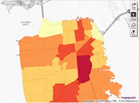
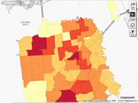
A geoset contains boundaries like states, counties, postcodes, storm tracks, or even custom polygon shapes. Here are a few examples of geosets.
 |
 |
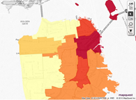 |
| Zip Codes | Police Districts | Supervisor Districts |
You can join a dataset to a geoset using matches between point locations in the dataset and geoset. The join will allow you to view your dataset thematically within the shapes of the geoset. This allows you to visualize the data within the shapes of the geoset – for example, to show the total amount of sales in each sales territory or the insured value of properties within a storm footprint.
Setting up the join
Through dataset settings
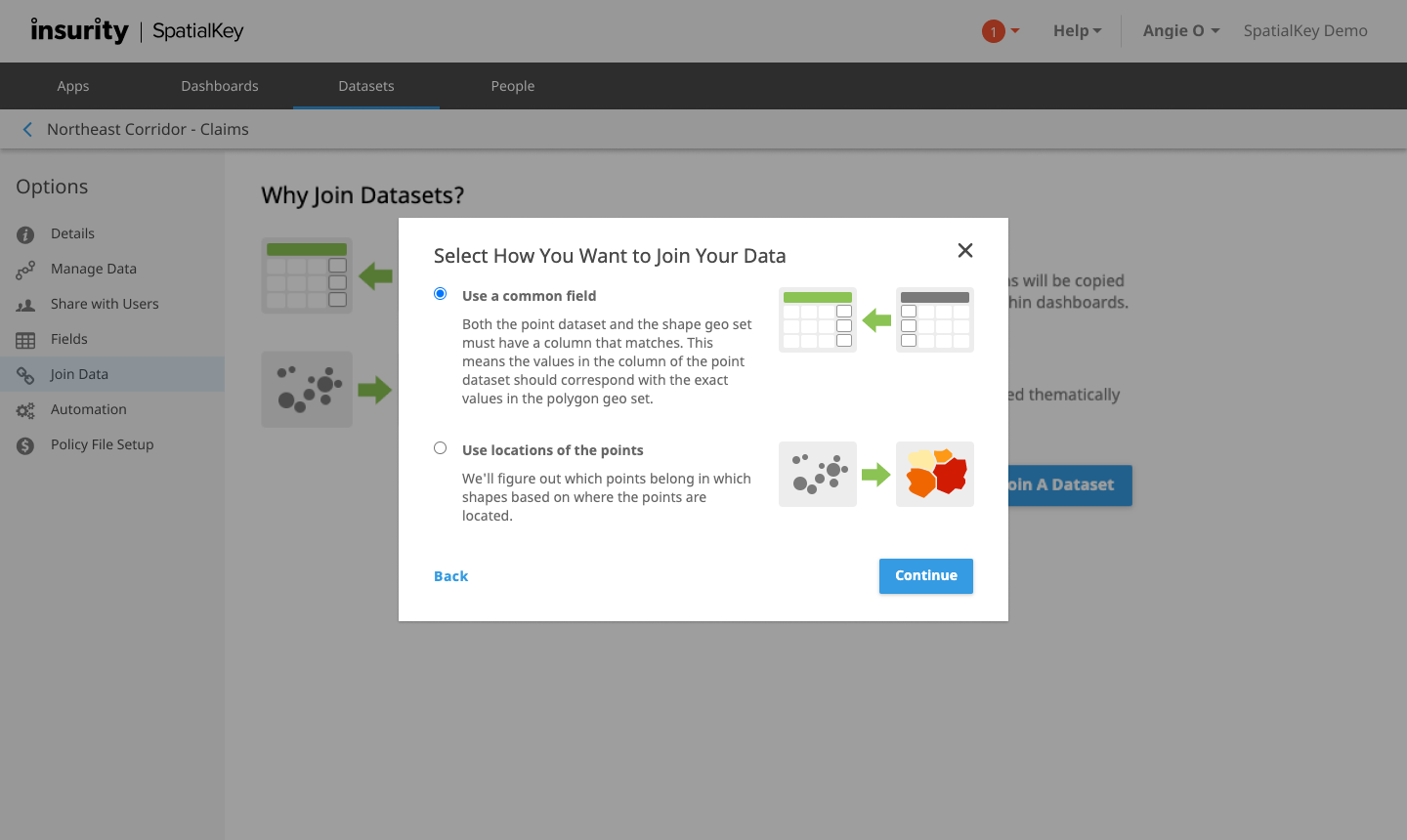
To begin, select the Datasets tab and find your dataset. Click on the gearicon to view data settings and select the “Join a Dataset” option on the left side of the screen. Note: you will only see this option if you are the Creator/Editor or Contributor of the dataset.
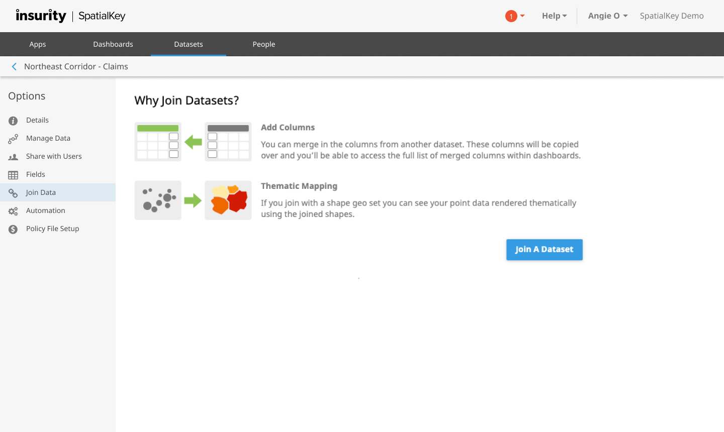
You’ll be walked through a couple of screens where you will select which data you want to join to your dataset and select how to join them together.
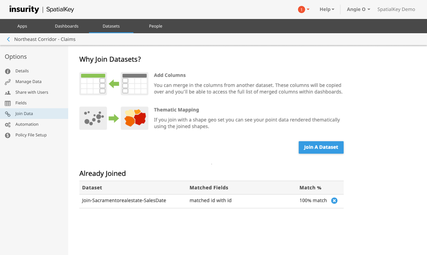
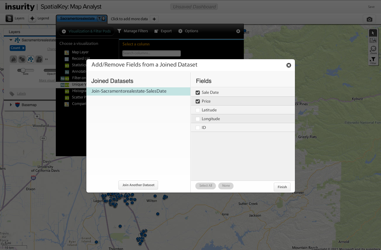
Once a join has been made with your dataset, it will appear in an “already joined” section of the screen.
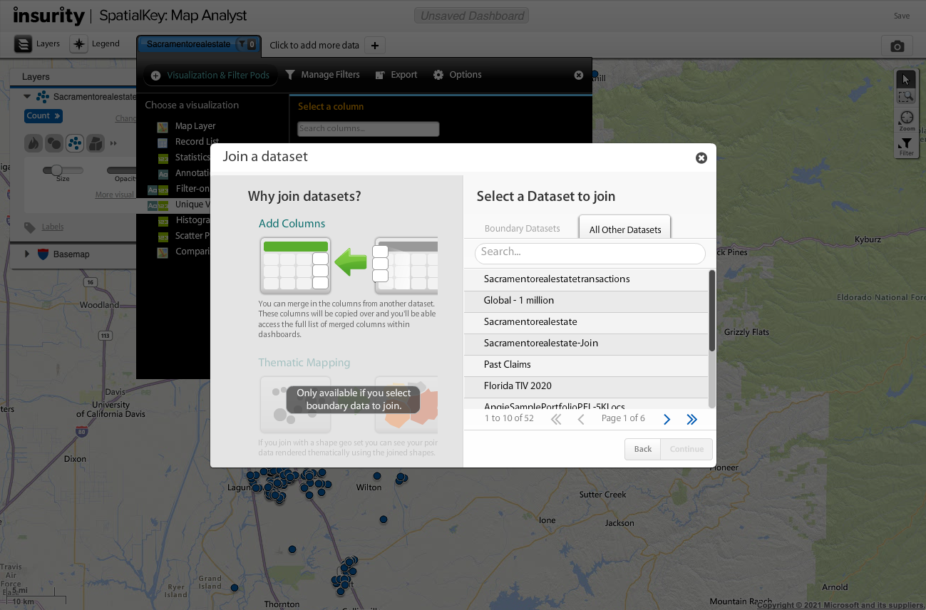
From within a Dashboard
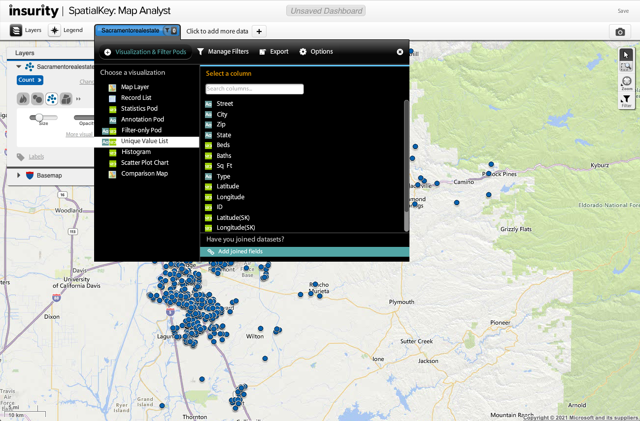
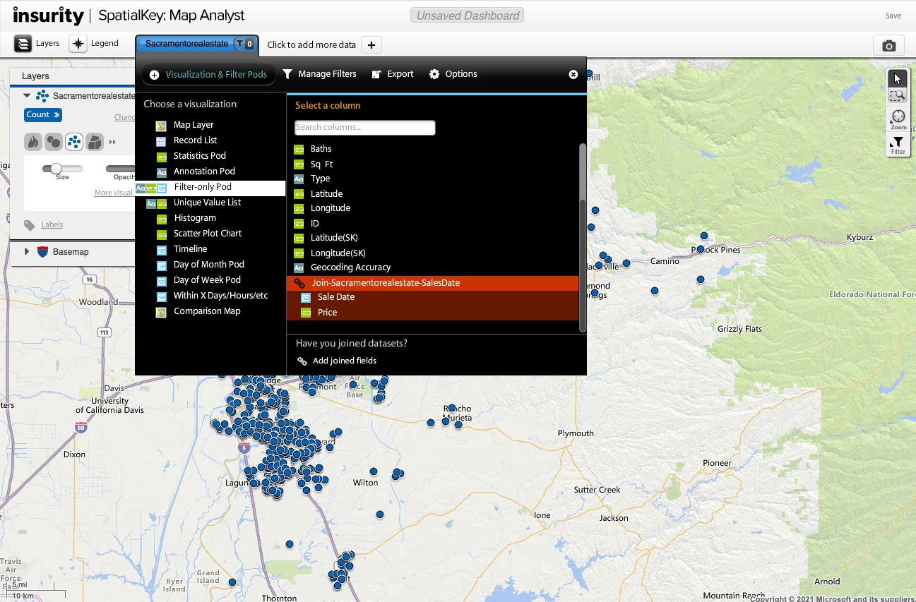
What happens if you are already working with a dataset in a dashboard and you realize that you forgot to set up your joins? Don’t worry, SpatialKey has made it easy to set up joins from within a Dashboard. Simply expand the dataset configuration panel, select a visualization, and “add fields from joined datasets”. Note: you will only see this option if you are the Creator/Editor or Contributor of the dataset.
You’ll be walked through a couple of screens where you will select which data you want to join to your dataset and select how to join them together.
Check out this article for tips on using dataset joins in your dashboard.